
Three 60-Year-Old Scottish Blokes Cycle the Divide
We had done some cycle tours before, usually a week to ten days long. Committing to being 4 weeks together in the wild west of North America was a daunting prospect.
All worked out fine in the end and we cycled for 24 days from Canmore, Canada to Last Chance Idaho, covering 1700km and quite a few vertical metres.
Day 1: Canmore to Spray Lake Campground. 57km 720m
We flew in to Calgary from Amsterdam (Gordon and Alasdair starting in Edinburgh, me starting in Vienna) via KLM and took the bus with our bikes to Canmore. Canmore was chosen as the starting point simply because we found cheaper accommodation there than in Banff. However the ride from there to Banff was along the highway and pretty unexciting.


Somehow we missed the good cycle shops in Canmore as in Banff they didn't have what I needed and told me Canmore was much better equipped. Too bad, I wasn't about to cycle back, not even over the shortcut.
The track from Banff was through pleasant forest with quite a few day-trippers, but became a bit more remote as we progressed. One could immediately understand why the Rockies are so named. Must have been a pretty daunting sight to the original settlers.


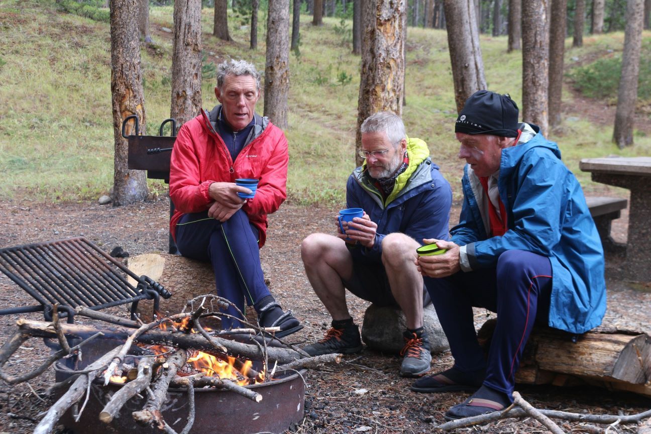
Eventually we got to the lake campground where a few sites were still available and pitched our 3 tents (at 60 you don't want to share a tent with your mates or brother). A swim and wash in the lake was the reward for the first day.

Day 2: Spray Lake to Mount Sarrail Campground 70km 623m
We chose to cycle the west side of the lake as the road on the east had a fair bit of traffic and would have been very dusty. It was the right decision, even if a bit longer. The route was very pleasant until hitting the parking area at the south of the lake from where we were on a wide gravel road and got severe dustings with each passing pickup truck.


Stopped at Boulton Creek expecting to find food and supplies but had to settle for a hot dog and ice cream. We camped at Mount Sarrail campground in the Peter Lougheed Provincial Park. A wash in the Upper Kananaskis Lake improved the situation though our after-dinner (sardines and rice) walk was cut short by grizzly sightings.
Wind and showers overnight. Nice campsite despite lack of facilities.
Day 3: Mount Sarrail to Elkford 70km
Followed a line of pylons over Elk Pass into British Columbia. Saw our first black bear at a respectable distance. Gordon immediately burst into song, Pinball Wizard I think, which kept the other thousand bears in the forest.


Once over the pass it was downhill to the Elk Valley then long quiet gravel road through the wide valley for miles, with fine mountains on either side, until the immense black coal mountain at the end of the Greenhills range. Behind this is one of the worlds biggest open cast coal mines. Just when you think you are in wild, pristine countryside...

Along the way we stopped for a break at a small lake where a couple of guys had a BBQ going on the back of their pickup. They offered to let us use their guns for target practice. Declined.
We found a motel in Elkford, complete with laundrette, shop and bar.
Day 4: Elkford to Corbin 75km 655m
Pleasant track out of Elkford with a short stretch on the highway. Got to Sparwood for some shopping and burger lunch just as the heavens opened. The sun finally came back and we set off round the "Flatwood Alternate". The first few kilometres of this was horrible - along a fast, busy highway. The road to Corbin was quiet and pleasant (it is a dead-end road to a disused mine), though had to shelter under bridges a couple of times from the rain.


Corbin is a dead mining town at the foot of what has been another huge open-cast coal mine. Spent a cold night at the foot of Coal Mountain.
Day 5: Corbin to Butts Cabin 54km 478m
Cold start along a muddy forest track. Gordon had major problems with the mud clogging his chain and derailleur. Met the sun higher up at the pass then a very rough descent, including along a river bed, into the Flathead Valley and along the gravel forest road and on to Butts Cabin (we did have to flag down a pickup and ask directions).


The cabin was quite a luxury with wood stove, though we were melting at night. Managed a wash in the river. Fantastic starry night outside but cold. Frost on the bikes in the morning.
Day 6: Butts Cabin to Trappers Cabin 80km 1230m
Missed the turn off to Cabin Forest Road then after the pass, missed the turn off to Wigwam River. Quite a pleasant though very long cycle up the river until hitting some single track in which I got a puncture. Then there was "The Wall" - quite a steep push up a slippery slope. 6km later we found Trappers Cabin. Only one bed, for which I drew the lucky straw. The wood stove again kept us too warm at night as we were too scared about bears to leave the door open.


Cold wash in the river. Managed to fix my puncture by adding sealant (was using tubeless tyres).
Day 7: Trappers Cabin to Eureka 46km 575m
Up and over the pass and down to Roosville and finger printing and face scanning at the US border. After burger we headed on down to Eureka. The camp site at the southern end of town had no facilities so we had to backtrack 4km uphill to the only motel around. Managed to wash clothes, eat badly, then eat badly again for breakfast (hash browns, massive omelette with too much cheese, endless weak coffee).

Day 8: Eureka to Wurtz Cabin 74km 973m
Cycled along some pleasant paved roads through forest and farmland before heading back over the hills to join the Flathead Valley again, with nice views of Glacier National Park.


We had pitched the tents behind Wurtz cabin when a huge pickup arrived and a guy with a side gun in a holster got out. This was Keith, retired firefighter from Florida with his girlfriend, who had reserved the cabin. They had decided not to use it because of a foot injury, and after spending some time round their camp fire they left and invited us to use the cabin. We immediately struck the tents and moved inside to comfortable beds.
There was a phone number on the door of Wurtz Cabin that you can call to rent it - but with no cell phone reception and the nearest pay phone 10 miles away that's not really an option.
Day 9: Wurtz Cabin to Whitefish 78km 973m
Left the Flathead River again to head over the hills to Whitefish. Nice and quite varied scenery today. Rear tyre again went flat on the downhill but managed to pump it up again. Had a quick visit to the Glacier Cyclery but decided a new tyre was too expensive and adding an inner tube would suffice. Stayed in motel in town for the night and did some washing.


Day 10: Whitefish to Wayfarers Campground Bigfork 73km 419m
A day of right angled bends on tarred roads through farming land and to Flathead Lake. Easiest day so far. Quite a pleasant campsite. A swim in the lake was most welcome as was our visit to the Flathead Brewery.


Day 11: Bigfork to Gravel Quarry in Flathead Forest 80km 1321m
Stocked up in local supermarket for next couple of days. Long uphill through forest, eventually giving up after a short navigation error (short but uphill and frustrating at the end of a tough day) and camping in an old gravel site with access to Piper Creek for water and cold wash.


Day 12: Gravel Quarry to Seeley Lake 99km 1386m
Long day with big climb. Easy going until lunchtime at Holland Lake then uphill a long way. Was not as hard as expected as the gradient and gravel road were good. Nice section of single track at top and down other side. Good views for once.


Long fast descent with some nasty washboarding which caused my front tyre to change shape! Bulges appeared on the walls and surface big enough for it to rub against the forks. Had to change the tyre just before Seeley Lake. Put it back on in the morning with an inner tube and it was fine for the rest of the trip. Bizarre - wish I had taken a video to show Schwalbe.
Night in motel with convenient supermarket next door.
Day 13: Seeley Lake to Cooper's Lake 80km 764m
First highlight of the day was ice cream and coffee in Ovando. There were lots of stuffed animals on the walls and beautiful wolf furs for sale at $1200, but would be nicer to see on the live animals I guess.


Short navigation errors cost us a few km effort. The next highlight was meeting 2 ranchers in their 6.7L pickup towards the end of a terrible empty, flat and washboarded section. Friendly chaps offered us cold beer from their car fridge. After that nice break and chat we headed short uphill to the "campsite" at Cooper's Lake. Only about 4 flat, stony pitches and a toilet so hardly a campsite, though pleasant site in the woods on the lake side. Also known as Big Nelson.
Day 14: Cooper's Lake to John and Barbara 77km 1285m
Couple of nice short passes then down to Lincoln for a burger lunch, then more up and down into cattle country and John and Barbara's cycle-friendly place. They have 3 huts for cyclists and possibility to camp with the Llamas in the field. We were told dinner was at 6pm and cold beer was in the fridge! All free, on the premise that we return the favour to other cyclists somewhere and sometime.


Ten cyclists plus John and Barbara at the dinner table with home grown vegetables, grilled steak and wine and beer. Quite a fascinating evening with various couples of varying ages who have travelled the world by bike for years. Brett joined us late on his cycle down from northern Alaska and a place was immediately made and more food drummed up.
Day 15: J&B to Helena 63km
Pleasant cycle through cattle country plus a bit of Interstate to Helena. Stayed at the Budget Inn motel downtown and decided to have a rest day.


Day 16: Rest Day in Helena
Visit to brewery, book shops, coffee shops in the rain. Met several of the cyclists from John and Barbara's place.
Day 17: Helena to Basin 63km 1467m
Drizzly cold start to the day and long slog up through damp forests (Grizzly Gulch). Stopped for break in the one-horse town of Basin and decided to stop for the night once the barman told us we could sleep in the community hall for $5 per person. Slept well on the stage there. Talked to the one drunk in the bar who was complaining about wealthy people coming up from Florida and elsewhere buying land and building ranches and who didn't even know how to hunt properly.


Day 18: Basin to Butte 61km 736m
Followed nice track along the Boulder River into horse and cow country. Then over the forest and down to Butte and the world's biggest open cast copper mine. The town was obviously wealthy at some point with large stone buildings on the north end, though mostly abandoned. We stayed in a massive soulless motel on the south end. Terrible food and a bit cold and miserable.

Day 19: Butte to Beaverdam Campground 58km 1015m
Cold and damp start but glad to leave Butte. Got caught in heavy rain at the start of the climb up Fleecer Mountain. Sheltered in a ruined two-seat cludge. Met up with Brett at the campsite and got a good fire going, though we were in bed by 8pm due to the cold.


Day 20: Beaverdam to Little Joe Campground 61km 940m
Cold overnight and tents soaked with condensation. Day marked by navigation error - climbed too high pushing bikes, annoying. Then extremely steep downhill section which we had to walk. Then lunch at Wise River and the Scottish owner Tom.


Major mistake not shopping enough at Wise River.
Got hit by thunder and hail just after pitching tents. Cold, wet and miserable, but got good fire going. Luckily could re-light it in the morning to help with packing up.


Day 21: Little Joe to Hansen Livestock Farm 104km 779m
Continued on tarred road to start with, up over pass then very cold descent to the next valley. Ma Barnes shop was shut. Stopped at tiny post office at Polaris. The lovely lady gave us various energy bars but confirmed there was no shop for miles. When asked how the locals manage if they need food, she replied "oh, we just shoot something".
The day was saved when I spotted a farm selling eggs and meat, though we ended up leaving EUR 20 as no-one had any change. Should have just bought more.


At the end of a long day we made it longer by doubling back to a place renting cabins but no-one was there. Headed on to the Hansen Livestock Farm which had a camping spot. The place was deserted so we made use of one of the cabins for cooking and getting out of the rain.
Day 22: Hansen Farm to Dell 88km 835m
Pleasant cow country surrounded by mountains. More mud problems for Gordon. After a pass we were in vast open country and had a very nice descent through a gorge towards the Interstate and Dell where we rented a log cabin and the petrol station shop sold cold beer.


Day 23: Dell to Upper Lake Campground 105km 749m
Headed south next the Interstate to Lima and a second breakfast surrounded by hunters and fat chaps sitting at the bar with their hash browns.
From there into huge open country where we could see mountains away in the distance. They were our goal. This was the longest day. Chased a moose for a mile or so. Pretty fed up by the end, but there was finally a nice campsite next the upper lake. Got a fire going and had the usual sardines and rice.


Day 24: Upper Lake to Last Chance Idaho 80km 429m
Crossed into Idaho on a nice enough gravel road. Seemed greener in Idaho and even got quite touristic near Big Springs. A horrible section of Interstate got us to Last Chance where we could get the Salt Lake Express to SLC, though we had to stay an extra night as it didn't stop for us on day 1. Big fishing country along the Snake River. We stayed in different log cabins on both nights and ate reasonably well at the local hotels. Was strange to finish the tour in such a non-place.


Epilogue
1,700km covered in 23 days. Average of 74km per day. Lots of climbing.
Would we do it again? Probably not. It was a super adventure, but days of only forest and dusty roads and motels and bad food...
Would we continue? Originally we thought yes, fly to SLC, bus to Yellowstone and do another couple of weeks, taking in the Teton mountains and Colorado... but, there's certainly other places to visit with beautiful and more varied countryside, and perhaps better food.
More photos at full size can be seen here.

The Gear
I didn't really have anything I didn't need and use. I carried our large and heavy water filter which we bought for India in 2004 and which we used a lot, but there are more modern light-weight, smaller alternatives. Omitting that would have meant less weight in my rucksack.
The last minute addition of a rear rack to my bike was very useful for carrying my Thermorest and spare tyre as these were bulky.
My dynamo and USB charger setup did not really work well and keeping my phone and GPS device charged was a problem. The phone had the GPX files and downloaded maps and saved us quite a few times, but not when the battery was dead. I failed to get the GPX files onto my Sigma GPS for various reasons. A power block and US charging adapter would have helped.
I do not have front shocks on my bike. I would probably get these if doing something similar as the downhills would have been much faster and pleasant.
I started off with tubeless tyres. The rear tyre went flat on me twice so I added a tube. The front tyre went all lumpy after a very fast bumpy descent, but adding a tube helped. So I'm not sold yet on the concept of tubeless.
I was only 59 years old when we did this.